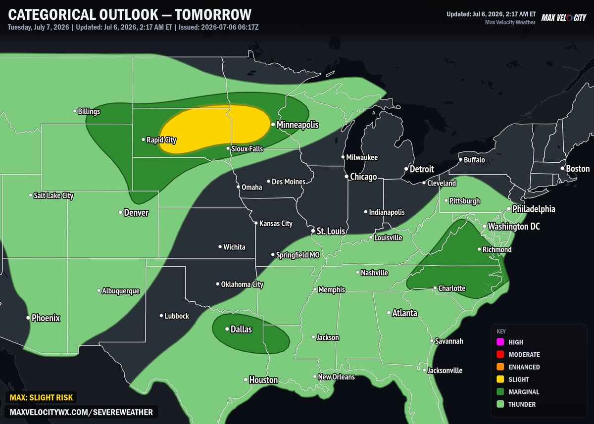
A level 2 risk is in place tomorrow across much of South Dakota into western Minnesota, where daytime heating underneath steep level lapse rates will lead to destabilization during the afternoon hours. Storms that do develop will focus along and south of a surface cold front connected to a Canadian cyclone, with deep layer shear will be supportive of some supercellular structures. As the evening progresses, a jet across South Dakota is expected to drive the cells upscale, transitioning them into an organized cluster travelling eastwards. As it does so, the threat for severe wind gusts will increase into the overnight hours.
For the fourth consecutive day in a row for some, another conditional threat of severe weather exists across the Mid-Atlantic, especially along and east of the Blue Ridge. Westerly flow will once again be week, but the continued presence of high precipitable water content in addition to solid instability will support strong, water-loaded downbursts within updrafts that can get organized. Some warm air advection in the low-levels could support an organized storm cluster, which is set to travel southeastwards toward the coast, carrying a continued risk for damaging winds along a consolidating gust front.
A third risk is in place across northeastern Texas into northern Louisiana, where thunderstorms throughout the late afternoon will focus near the southwestern side of a broad, weak mid-level circulation stagnant over the Mid-South. Some instability along a corridor of enhanced daytime heading will lead to the potential of storm clustering by the afternoon hours, where the strongest cells within them carrying the best potential for a few localized downbursts.







 CHIRAGddd